Accessibility Controls
Accessibility Options
Text Size Increase
Text Size Decrease
Dark/Light Contrast
Invert
Highlight Links
Show/Hide Images
Default Cursor
Saturation
Change Theme Color

Accessibility Options
Text Size Increase
Text Size Decrease
Dark/Light Contrast
Invert
Highlight Links
Show/Hide Images
Default Cursor
Saturation
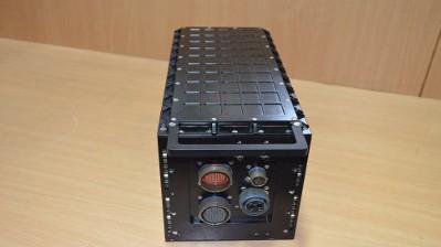
The Indigenous Digital Map Generator (I-DMG) generates moving map graphics along with symbology overlay and drives
the video outputs for display based upon commands and information received via the MIL-STD-1553B multiplex Data Bus
(Mux bus).Provides mission support functionality by indication of navigation parameters (Waypoints, Flight Plan) and
Threat on background of various map information.